Category:West Challow
Jump to navigation
Jump to search
village and civil parish in Vale of White Horse district, Oxfordshire, England  | |||||
| Upload media | |||||
| Instance of | |||||
|---|---|---|---|---|---|
| Location | Vale of White Horse, Oxfordshire, South East England, England | ||||
 | |||||
Subcategories
This category has the following 2 subcategories, out of 2 total.
M
- Manor Farm, West Challow (4 F)
W
Media in category "West Challow"
The following 93 files are in this category, out of 93 total.
-
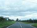
 A417 - Faringdon Road, west of Mill Farm - geograph.org.uk - 4011868.jpg 3,648 × 2,736; 2.41 MB
-

-
 A417 crosses Stutfield Brook - geograph.org.uk - 4011889.jpg 3,489 × 2,546; 1.51 MB
-
 A417 crosses the railway by Challow Station - geograph.org.uk - 4011882.jpg 3,529 × 2,706; 1.77 MB
-
 A417-Circourt Road junction - geograph.org.uk - 3131415.jpg 640 × 481; 43 KB
-
 A417-Goosey Lane junction - geograph.org.uk - 3131430.jpg 640 × 480; 55 KB
-
 Across the field to the canal - geograph.org.uk - 1638808.jpg 640 × 480; 73 KB
-
 Benchmark on parapet of Stutfield Bridge - geograph.org.uk - 2830453.jpg 683 × 1,024; 259 KB
-
 Board on the bridge - geograph.org.uk - 1638859.jpg 640 × 480; 130 KB
-
 Brickwork by the canal - geograph.org.uk - 1639647.jpg 480 × 640; 159 KB
-
 Brickwork in the weeds - geograph.org.uk - 1639826.jpg 640 × 480; 162 KB
-
 Brickwork the other side - geograph.org.uk - 1639650.jpg 640 × 480; 149 KB
-

-

-
 Bridleway to Childrey - geograph.org.uk - 2485691.jpg 1,500 × 1,000; 208 KB
-
 Bridleway to East Challow - geograph.org.uk - 2485677.jpg 1,500 × 1,000; 167 KB
-
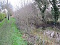
 Canal along the field - geograph.org.uk - 1638818.jpg 640 × 480; 84 KB
-
 Canal along the towpath - geograph.org.uk - 1639188.jpg 480 × 640; 136 KB
-
 Canal by the hedge - geograph.org.uk - 1639841.jpg 640 × 480; 136 KB
-
 Canal by the road - geograph.org.uk - 1639227.jpg 640 × 480; 144 KB
-
 Canal from the bridge - geograph.org.uk - 1638849.jpg 480 × 640; 135 KB
-
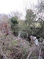 Canal in the growth - geograph.org.uk - 1639626.jpg 480 × 640; 131 KB
-
 Canal in the trees - geograph.org.uk - 1638811.jpg 640 × 480; 150 KB
-
 Canal to the road - geograph.org.uk - 1639580.jpg 640 × 480; 138 KB
-
 Canal towards the road - geograph.org.uk - 1638878.jpg 480 × 640; 136 KB
-
 Challow Compound, near Challow Station, Oxon - geograph.org.uk - 5420019.jpg 1,024 × 683; 189 KB
-
 The Leather Bottle pub, Challow Station - geograph.org.uk - 82286.jpg 640 × 480; 122 KB
-
 Charter train waits in Challow Down Loop - geograph.org.uk - 2764354.jpg 1,024 × 683; 152 KB
-
 Childrey in the distance - geograph.org.uk - 1637977.jpg 640 × 480; 51 KB
-
 Cornhill Lane to the A417 - geograph.org.uk - 2485668.jpg 1,500 × 1,000; 272 KB
-
 Culvert at the road - geograph.org.uk - 1639218.jpg 640 × 480; 146 KB
-
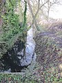
 Culvert in the canal - geograph.org.uk - 1638891.jpg 640 × 480; 137 KB
-
 Culvert under the bridge - geograph.org.uk - 1638868.jpg 480 × 640; 133 KB
-
 Display on the bridge - geograph.org.uk - 1638843.jpg 640 × 480; 103 KB
-
 Faringdon Road at the junction of Silver Lane - geograph.org.uk - 6309117.jpg 1,920 × 1,280; 806 KB
-
 Faringdon Road crosses Stutfield Bridge - geograph.org.uk - 4235818.jpg 1,500 × 999; 218 KB
-
 Faringdon Road entering Challow Station - geograph.org.uk - 4235827.jpg 1,500 × 983; 181 KB
-
 Faringdon Road near West Challow - geograph.org.uk - 3131409.jpg 640 × 480; 50 KB
-
 Faringdon Road passes Goosey Lane - geograph.org.uk - 4235821.jpg 1,500 × 999; 154 KB
-
 Farmland south of West Challow - geograph.org.uk - 5049663.jpg 1,024 × 768; 225 KB
-
 Farmland, West Challow - geograph.org.uk - 2678458.jpg 640 × 480; 106 KB
-
 Farmland, West Challow - geograph.org.uk - 2678512.jpg 640 × 480; 131 KB
-
 Farmland, West Challow - geograph.org.uk - 2678525.jpg 640 × 480; 118 KB
-
 Farmland, West Challow - geograph.org.uk - 2678533.jpg 640 × 480; 152 KB
-
 Farmland, West Challow - geograph.org.uk - 6190657.jpg 1,024 × 683; 215 KB
-
 Farmland, West Challow, Oxfordshire - geograph.org.uk - 4688675.jpg 3,137 × 2,149; 1.51 MB
-
 Fence by the towpath - geograph.org.uk - 1639209.jpg 480 × 640; 143 KB
-
 Field south of the main line - geograph.org.uk - 5021219.jpg 640 × 317; 27 KB
-
 Filled in Canal - geograph.org.uk - 1638815.jpg 640 × 480; 77 KB
-
 Footpath through the field to Childrey - geograph.org.uk - 2485686.jpg 1,500 × 1,000; 164 KB
-
 Footpath to East Challow along the canal - geograph.org.uk - 2485713.jpg 1,500 × 1,000; 303 KB
-
 Goosey Lane - geograph.org.uk - 6309422.jpg 1,920 × 1,280; 1.09 MB
-
 Looking towards the bend - geograph.org.uk - 1651744.jpg 640 × 480; 132 KB
-
 Mellors Garage, East Challow - geograph.org.uk - 6099745.jpg 1,824 × 1,114; 1.17 MB
-
 Near Petwick Farm - geograph.org.uk - 5258749.jpg 640 × 287; 50 KB
-
 New housing under construction, Challow Station - geograph.org.uk - 2154645.jpg 1,024 × 768; 228 KB
-
 Oak tree by the path - geograph.org.uk - 1638822.jpg 480 × 640; 96 KB
-
 Path to Childrey - geograph.org.uk - 1638835.jpg 480 × 640; 76 KB
-
-
 Road from Goosey meets the A417 - geograph.org.uk - 1724222.jpg 640 × 480; 77 KB
-
 Road from the village - geograph.org.uk - 1639233.jpg 640 × 480; 96 KB
-
 Road into West Challow - geograph.org.uk - 1639223.jpg 640 × 480; 103 KB
-
 Seat on the other bank - geograph.org.uk - 1639593.jpg 640 × 480; 128 KB
-
 Seat on the towpath - geograph.org.uk - 1639199.jpg 640 × 480; 139 KB
-
 Side of the bridge - geograph.org.uk - 1638885.jpg 480 × 640; 121 KB
-
 Sign to the path - geograph.org.uk - 1639564.jpg 480 × 640; 151 KB
-
 Signal gantry near Goosey - geograph.org.uk - 1539444.jpg 640 × 409; 51 KB
-
 Silver Lane over West Challow Bridge - geograph.org.uk - 2485701.jpg 1,500 × 1,000; 330 KB
-
 Silver Lane to West Challow - geograph.org.uk - 2485671.jpg 1,500 × 1,000; 134 KB
-
 Silver Lane to West Challow - geograph.org.uk - 2485696.jpg 1,500 × 1,000; 136 KB
-
 Sleepers on the bank - geograph.org.uk - 1639183.jpg 640 × 480; 118 KB
-
 St Laurence Church in West Challow - geograph.org.uk - 2485723.jpg 1,500 × 1,000; 196 KB
-

-
 Stutfield Bridge - geograph.org.uk - 2830523.jpg 1,024 × 683; 212 KB
-
 The junction of Silver Lane and the A417 - geograph.org.uk - 2485673.jpg 1,500 × 1,000; 109 KB
-
 The route of the former Wilts & Berks Canal - geograph.org.uk - 2485708.jpg 1,500 × 1,000; 371 KB
-
 The site of the former Challow Station - geograph.org.uk - 4007330.jpg 4,752 × 3,168; 3.42 MB
-
 The Wilts & Berks Canal from West Challow Bridge - geograph.org.uk - 2485718.jpg 1,500 × 1,000; 362 KB
-
 Towpath by the canal - geograph.org.uk - 1638874.jpg 640 × 480; 127 KB
-
 Vegetation in the canal - geograph.org.uk - 1639204.jpg 640 × 480; 135 KB
-
 View from a Reading-Swindon train - Crossing Land Brook - geograph.org.uk - 5530268.jpg 1,600 × 1,200; 435 KB
-
 View of the bridge - geograph.org.uk - 1638906.jpg 640 × 480; 124 KB
-

-
 Bench under the tree - geograph.org.uk - 1651727.jpg 640 × 480; 129 KB
-
 Canal by the road - geograph.org.uk - 1639238.jpg 640 × 480; 125 KB
-
 Culvert under the road - geograph.org.uk - 1638031.jpg 480 × 640; 126 KB
-
 Map of the Wilts & Berks Canal - geograph.org.uk - 1639571.jpg 640 × 480; 129 KB
-
 Name in the concrete - geograph.org.uk - 1638901.jpg 640 × 480; 128 KB
-
 Plaques on the bench - geograph.org.uk - 1651736.jpg 640 × 480; 109 KB
-
 Lock or bridge - geograph.org.uk - 1639824.jpg 640 × 480; 148 KB
-
 Willows over the field - geograph.org.uk - 1637986.jpg 640 × 480; 84 KB
-
 Wilts ^ Berks Canal at West Challow - geograph.org.uk - 5231356.jpg 1,280 × 960; 575 KB
-
 Windmill Hill to Letcombe Regis - geograph.org.uk - 2485655.jpg 1,500 × 1,000; 264 KB


